Developed by Hove, a Keolis subsidiary, Patterns is a tool that helps to understand journeys on a territory-wide scale, whatever the mode of transport used. The use of anonymized GPS data allows all mobility flows to be revealed.
Patterns CO2, data to serve mobility!
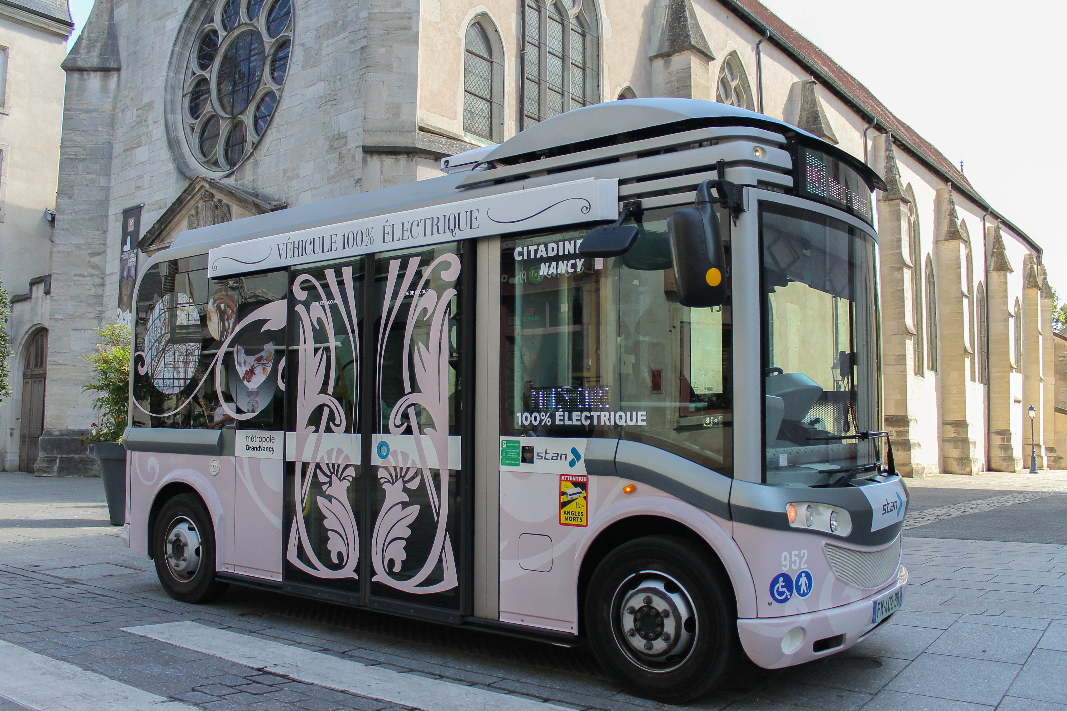
#1 – NANCY
The Patterns solution has been enhanced with a dynamic carbon footprint measurement module. In 2022, the Nancy Metropolis has chosen to use this functionality to steer the decarbonization of its transport and achieve its greenhouse gas emission reduction targets. The data will be used to support planning decisions and changes to the transport offer, and to report on their impact.
#2 – PARIS
Tracking pedestrians' tempo In 2020, the City of Paris studied pedestrian movements: distances, travel times, routes to access public transport, etc. The data, collected and processed by Hove, was used to model and analyze pedestrian flows and density, and to target areas where improvements would be needed to relieve sidewalk congestion. This approach was then applied to the development of the banks of the Seine.
#3 �– BOSTON
Understanding post-Covid mobility behavior In Boston, Patterns was used to analyze passenger travel between 2019 and 2022, both before and after the Covid-19 pandemic, on the Commuter Rail network. Observation on the network's 12 lines was based on weekly and daily patterns, as well as origin-destination matrix data. These data enabled local teams to better understand behavior since the end of the pandemic, and to adapt the transport offer to better regain passengers.
#4 - BORDEAUX
A not-to-be-missed event for wine lovers, "Bordeaux fête le vin" attracts almost 200,000 visitors every year. In 2022, the city chose to use Patterns to gain a better understanding of travel patterns during the event. GPS data were used to measure the volume of traffic generated in the area, the modes of transport used, the origin of visitors, and the impact in terms of mobility compared to other times of the year.